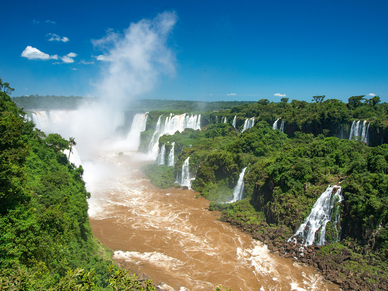
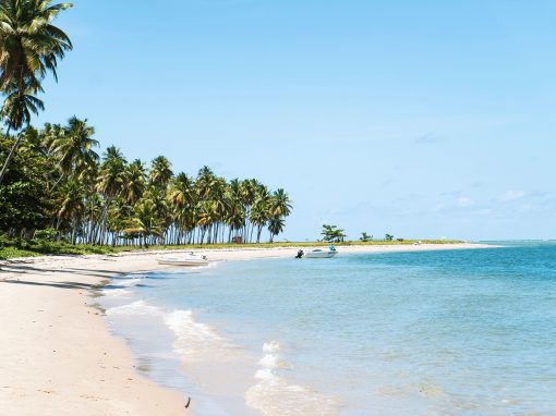
Whether you’re discovering iconic landmarks, admiring breathtaking natural wonders, or diving into the energy of vibrant cities, South America offers endless unforgettable adventures. Discover our curated guide to the 25 best places to visit, listed in no particular order.
Machu Picchu, Peru—Journey to the Lost City
Machu Picchu stands as one of the most iconic archaeological sites globally, nestled between Machu Picchu Mountain and Huayna Picchu. Constructed in the 15th century during the reign of Inca emperor Pachacuti, it earned the nickname “Lost City of the Incas” after its rediscovery by American explorer Hiram Bingham in 1911, having been forgotten by the outside world for centuries.
The site is celebrated for its remarkable architecture, advanced engineering, and stunning natural setting. Machu Picchu is divided into two primary sections: the agricultural sector, with terraces used for farming, and the urban sector, featuring temples, plazas, and residential areas. Notable structures include the Temple of the Sun, the Room of the Three Windows, and the Intihuatana stone, which is linked to the astronomical calendar.
The precision of Inca construction, with stone blocks fitting together without mortar, demonstrates their sophisticated architectural skills and their ability to adapt to the challenging mountainous terrain. The site likely served as a significant religious, ceremonial, and administrative center, possibly a royal estate or a retreat for Inca nobility.
Machu Picchu’s remote location and its harmonious integration with the surrounding landscape enhance its allure. As part of the Machu Picchu Historical Sanctuary, it is home to diverse flora and fauna. Now a UNESCO World Heritage Site and one of the New Seven Wonders of the World, Machu Picchu attracts over a million visitors annually. Accessible via the Inca Trail or by train from Aguas Calientes, it remains a must-visit destination for travelers and history enthusiasts, embodying the ingenuity and lasting legacy of the Inca civilization.
Machu Picchu Quick Facts:
- Location: In the Andes Mountains of Peru, about 80 kilometers (50 miles) northwest of Cusco.
- Altitude: Approximately 2,430 meters (7,970 feet) above sea level.
- Best Time to Visit: The peak tourist season is from June to August. The dry season (April to October) is generally considered the best time to visit. The rainy season is from November to March.
- Climate: Weather can vary greatly; it can be sunny, rainy, or cloudy, so it’s best to prepare for all conditions. Bring layers, including rain gear.
- Tickets: Entry tickets to Machu Picchu need to be purchased in advance.
- Access: The site can be accessed by train from Cusco or Ollantaytambo to Aguas Calientes, followed by a short bus ride or a hike up to the site.
- Guided Tours: Guided tours are recommended to fully understand the history and significance of the site.
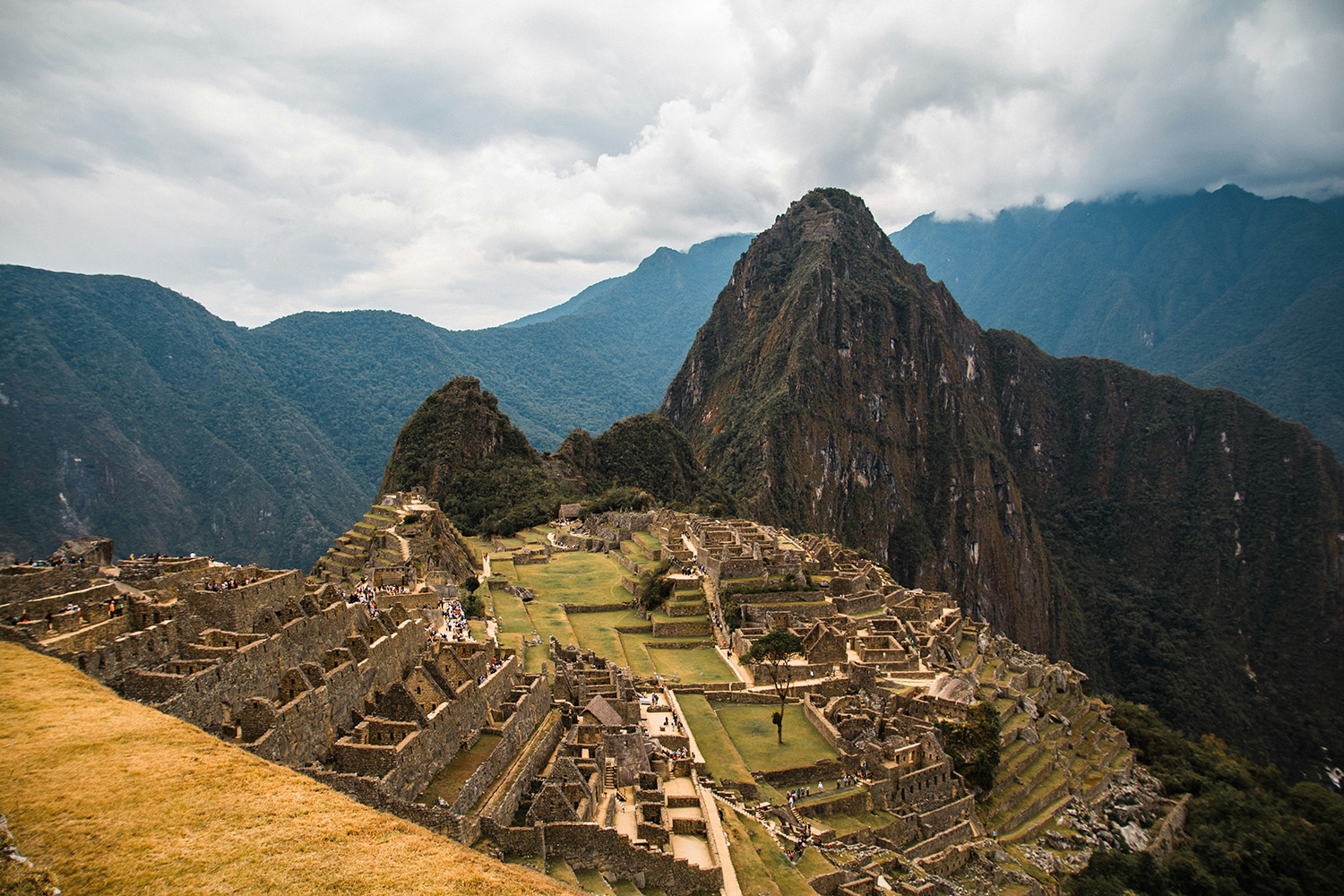
Discover the timeless wonder of Machu Picchu—where ancient Inca engineering meets breathtaking mountain vistas. Photo by Adrian Dascal on Unsplash.
Torres del Paine National Park, Chile—Exploring the Untamed Wilderness
Torres del Paine National Park is one of the most spectacular and renowned natural wonders in the world. The park is celebrated for its striking landscapes that include jagged granite peaks, expansive glaciers, crystal-clear lakes, and lush valleys. The iconic Torres del Paine, a trio of towering granite spires, stands as the park’s centerpiece, offering breathtaking views that attract hikers and climbers from around the globe.
The park features a diverse range of ecosystems, from the windswept steppe and temperate rainforests to the icy expanses of glaciers like Grey Glacier and the Southern Patagonian Ice Field. It is home to an impressive array of wildlife, including guanacos, Andean condors, Chilean foxes, and the elusive puma. The rich biodiversity and varied landscapes provide ample opportunities for wildlife viewing and photography.
Torres del Paine is renowned for its world-class trekking routes. The W Trek and the O Circuit are among the most popular, offering stunning vistas of the park’s natural beauty. The W Trek, which typically takes 4-5 days, covers the park’s main highlights, including the Torres del Paine massif, the French Valley, and the Glacier Grey. The more challenging O Circuit, a full loop that usually takes around 8-10 days, provides a comprehensive exploration of the park’s remote and varied landscapes.
Visitors can also enjoy activities such as kayaking, mountain biking, and boat tours on the park’s pristine lakes. The park’s facilities include various lodges, refugios, and campsites, catering to different levels of comfort and adventure.
With its dramatic scenery and diverse natural beauty, Torres del Paine National Park is not only a destination for trekkers and nature lovers but also a symbol of the awe-inspiring grandeur of Patagonia. Its rugged terrain and serene beauty make it a quintessential experience for those seeking to connect with the raw and unspoiled essence of the natural world.
Torres del Paine National Park Quick Facts:
- Location: Situated in southern Chilean Patagonia, near the town of Puerto Natales.
- Size: The park covers approximately 242,000 hectares (597,000 acres) and is known for its diverse landscapes, including mountains, glaciers, lakes, and rivers.
- Best Time to Visit: The prime visiting season is from November to March (Southern Hemisphere summer), when the weather is milder and the park is more accessible. Winter months (June to September) can be harsh and cold.
- Entrance Fees: There is an entrance fee to access the park. Fees can be paid at park entrances or online in advance. Approximately US$40 per person (2024).
- Accommodation: The park offers a range of accommodation options, from campsites and refugios to luxury lodges. Book in advance, especially during peak season.
- Transportation: Access to the park is typically via Puerto Natales or Punta Arenas. From these towns, you can take buses or arrange private transfers to the park.
- Permits: For trekking routes like the W or O Circuit, you may need to obtain permits. These can be arranged through the park or with tour operators.
- Wildlife: The park is home to diverse wildlife, including guanacos, condors, and the elusive Andean fox. Keep a respectful distance from wildlife and follow park guidelines.
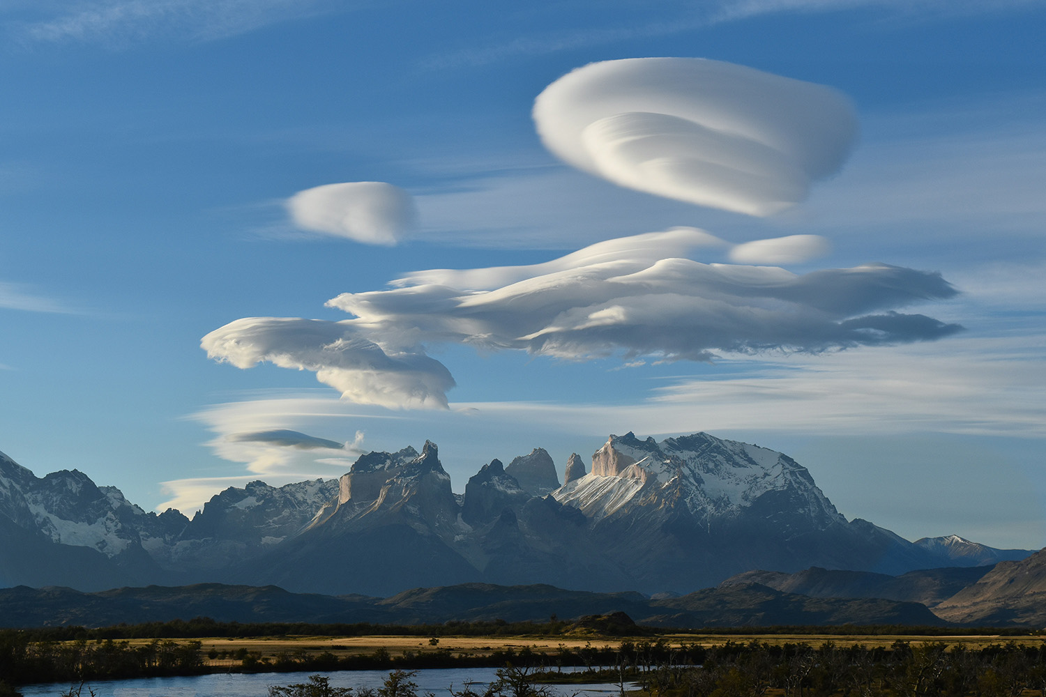
Immerse yourself in the majestic beauty of Torres del Paine. Photo by Marc Thunis on Unsplash.
Buenos Aires, Argentina—The Vibrant Heartbeat of Argentina
Buenos Aires, the lively capital of Argentina, effortlessly combines European sophistication with Latin American fervor. Known for its rich cultural scene, Buenos Aires is the birthplace of tango, with milongas and dance halls found throughout the city. The architecture is a mix of grand colonial buildings, modern skyscrapers, and charming neighborhoods like San Telmo and La Boca, each with its own distinct character.
The city’s streets are lined with cafés, world-class restaurants, and theaters, making it a hub for gastronomy and the arts. Plaza de Mayo, the historic heart of Buenos Aires, is surrounded by important landmarks like the Casa Rosada, while Avenida 9 de Julio, one of the widest avenues in the world, leads to the iconic Obelisk.
Buenos Aires is also home to the elegant Recoleta Cemetery, where many of Argentina’s most famous figures are buried, and the lively Palermo district, known for its parks, boutique shops, and nightlife. Whether you’re exploring its historic sites, indulging in delicious Argentine cuisine, or dancing the night away, Buenos Aires offers an unforgettable experience filled with energy and charm.
Buenos Aires Quick Facts:
- Location: The capital city of Argentina is located on the eastern shore of the Rio de la Plata estuary.
- Language: The official language is Spanish. English is not widely spoken, so learning a few basic phrases can be helpful.
- Currency: The local currency is the Argentine Peso (ARS). Credit cards are widely accepted, but it’s a good idea to carry some cash for small purchases.
- Best Time to Visit: The best times to visit are during the spring (September to November) and fall (March to May) when the weather is mild. Summers can be hot, and winters are cool.
- Climate: Buenos Aires has a temperate climate. Summers are hot and humid, while winters are cool and damp. Pack accordingly for the season.
- Transportation: The city has an extensive public transportation system, including buses, subways (Subte), and taxis. Consider purchasing a SUBE card for use on public transit.
- Safety: Buenos Aires is generally safe, but like any major city, it’s wise to stay alert and avoid displaying valuable items.
- Top Tourist Attractions: Historic Plaza de Mayo, colorful neighborhood of La Boca, elegant Recoleta Cemetery, Bustling Avenida 9 de Julio.
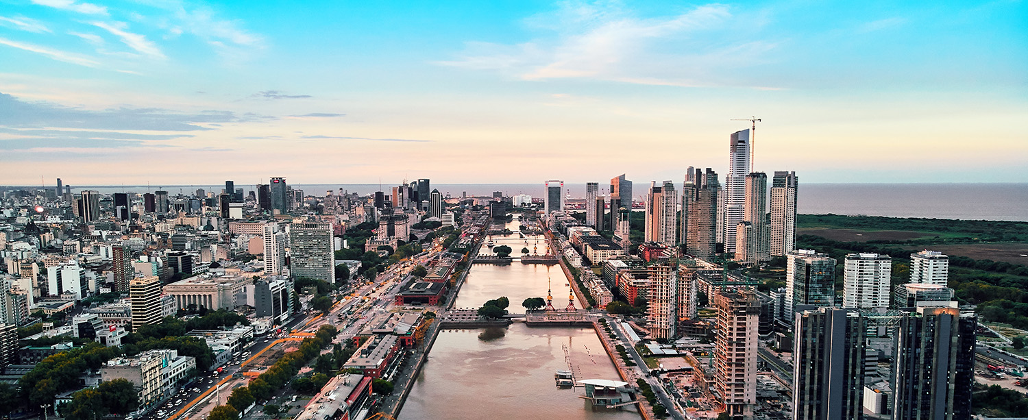
Experience the vibrant energy of Buenos Aires—where European charm meets Latin American soul. Photo by Deensel, under the CC BY 2.0 <https://creativecommons.org/licenses/by/2.0> license, via Wikimedia Commons.
Salar de Uyuni, Bolivia—The World’s Largest Mirror and Bolivia’s Gem
Salar de Uyuni is the largest salt flat in the world, spanning over 10,000 square kilometers (about 3,900 square miles). This vast, otherworldly landscape is renowned for its breathtaking beauty, especially during the rainy season when a thin layer of water transforms the salt flats into a giant mirror, reflecting the sky in a surreal, endless horizon.
Formed from the remnants of prehistoric lakes, Salar de Uyuni not only serves as a major source of lithium but also draws travelers from around the world to marvel at its stunning vistas, vibrant sunsets, and unique geological formations like Isla Incahuasi, an island adorned with giant cacti.
The salt flat is also a popular destination for photography, with its reflective surface creating optical illusions and dreamlike images. Beyond its natural beauty, the area offers opportunities for adventure, including 4×4 tours, visits to nearby geysers, hot springs, and the hauntingly beautiful train graveyard near the town of Uyuni.
Salar de Uyuni Quick Facts:
- Location: Located in southwestern Bolivia, near the town of Uyuni, in the Andes Mountains.
- Altitude: The Salar is located at an altitude of approximately 3,656 meters (11,995 feet) above sea level. Be prepared for high-altitude conditions and potential altitude sickness.
- Size: The salt flat covers approximately 10,582 square kilometers (4,086 square miles), making it the largest salt flat in the world.
- Best Time to Visit: During the dry season from May to October, the salt flats offer ideal conditions for clear views of the salt crust and exploration of the area. In contrast, the wet season from November to April can transform the salt flats with a thin layer of water, creating a stunning mirror effect. However, this can also make some roads and attractions less accessible.
- Climate: Expect extreme temperature variations, with hot days and cold nights. Temperatures can drop below freezing, especially at night.
- Transportation: Access is usually from Uyuni, which is reachable by flights from La Paz, or by bus from other Bolivian cities. Tours to the salt flats are commonly arranged from Uyuni.
- Tours: Most visitors explore the salt flats via guided tours, which range from day trips to multi-day excursions. Tours often include visits to nearby attractions such as the train graveyard, Eduardo Avaroa National Park, and colored lagoons.
- Accommodation: Basic accommodations are available in Uyuni and in some remote locations near the salt flats. For unique experiences, consider staying in a salt hotel made from blocks of salt.
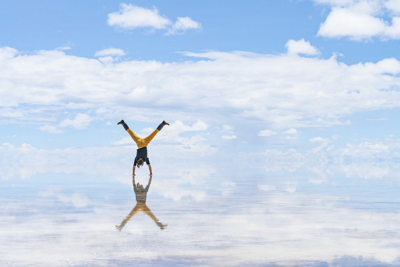
Step into the surreal beauty of Salar de Uyuni—where the sky meets the earth in a breathtaking mirror of endless horizons. Photo by Yolanda_Jost on Pixabay.
Rio de Janeiro, Brazil—The Vibrant Heart of Brazil’s Beaches and Carnival
Rio de Janeiro, Brazil’s vibrant coastal city, is famous for its stunning landscapes, lively culture, and iconic landmarks. Nestled between lush mountains and golden beaches, Rio is home to world-renowned attractions such as Christ the Redeemer atop Corcovado Mountain, the lively Copacabana and Ipanema beaches, and the towering Sugarloaf Mountain. The city’s energetic spirit comes alive during Carnival, one of the world’s largest and most colorful festivals, showcasing samba music, dance, and elaborate parades.
Rio’s diverse neighborhoods offer a mix of experiences, from the historic charm of Santa Teresa to the bohemian vibes of Lapa. Visitors can explore the rich cultural heritage at sites like the Museu do Amanhã and the Maracanã Stadium, one of the most famous football arenas globally. Whether you’re taking in panoramic views from the top of Sugarloaf, enjoying a sunset on the beach, or dancing the night away in a samba club, Rio de Janeiro offers an unforgettable experience filled with rhythm, beauty, and joy.
Rio de Janeiro Quick Facts:
- Location: Southeastern Brazil, along the Atlantic coast
- Language: The official language of Brazil is Portuguese. In major cities and tourist areas, you might find people who speak English or Spanish, but proficiency can vary.
- Currency: The official currency used in Brazil is the Brazilian Real (BRL).
- Best Time to Visit: December to March (summer season) for warm weather and vibrant festivals, including Carnival.
- Climate: Tropical climate with hot, humid summers and mild, rainy winters. Average temperatures range from 23°C to 30°C (73°F to 86°F).
- Transportation: Extensive public transport options including buses, metro, and taxis. Ride-sharing services like Uber are also widely available.
- Safety: Rio has areas with varying safety levels. It’s advisable to stay aware of your surroundings, avoid certain neighborhoods at night, and use reputable transportation options.
- Top Tourist Attractions: Christ the Redeemer, Sugarloaf Mountain, Copacabana and Ipanema Beaches, Selarón Steps, Maracanã Stadium, Tijuca National Park, Lapa Arches.
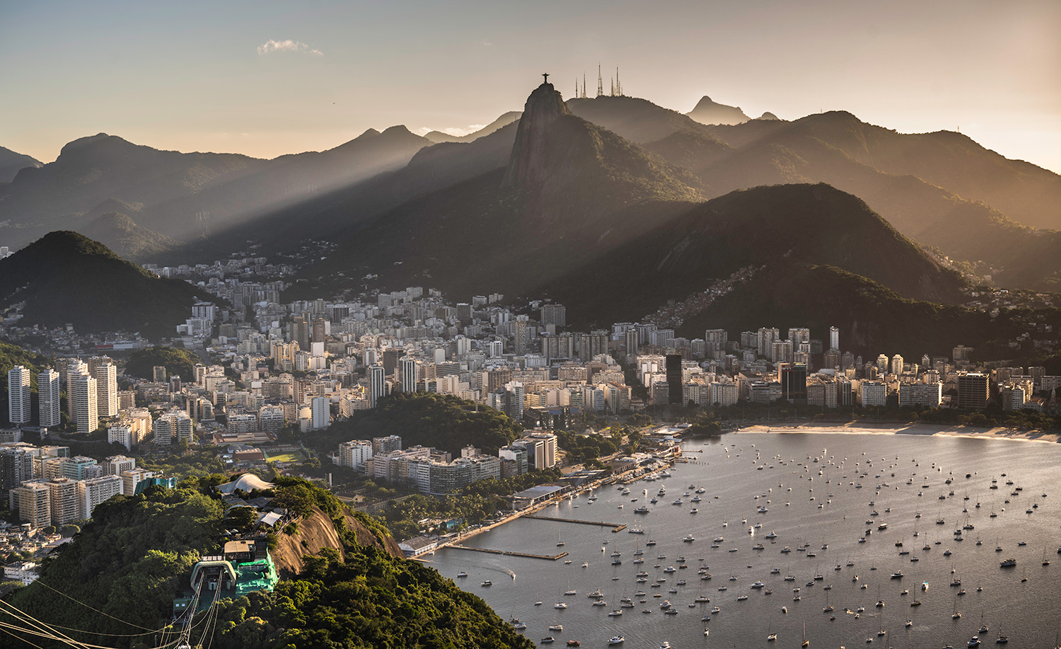
Embrace the vibrant energy of Rio de Janeiro—where stunning beaches, iconic landmarks, and endless rhythm create a city like no other. Photo by Wilfredo Rafael Rodriguez Hernandez, under the CC0 1.0 Universal Public Domain Dedication license, via Wikimedia Commons.
Galápagos Islands, Ecuador—Discover Untamed Wildlife and Unique Ecosystems
The Galápagos Islands are renowned for their unique biodiversity and stunning natural beauty. This volcanic archipelago consists of 19 islands and numerous islets, each offering diverse ecosystems and habitats. The islands are famous for their remarkable wildlife, including giant tortoises, marine iguanas, and a variety of endemic bird species, such as the finches that influenced Charles Darwin’s theory of evolution.
Visitors to the Galápagos can explore its pristine landscapes, which range from lush highlands and arid lowlands to dramatic volcanic terrain. Activities include snorkeling with vibrant marine life, diving in crystal-clear waters, and hiking across diverse environments. The archipelago is a UNESCO World Heritage Site and is managed by the Galápagos National Park, which works to preserve its delicate ecosystems while offering sustainable tourism experiences.
Tourism in the Galápagos focuses on eco-friendly practices, ensuring that visitors experience the islands’ natural wonders while minimizing their impact on the environment. Guided tours and cruises offer opportunities to encounter the unique flora and fauna while also providing educational insights into the conservation efforts that protect this extraordinary destination.
Galápagos Islands Quick Facts:
- Location: Ecuador Pacific Ocean, about 1,000 km (620 miles) off the coast of mainland Ecuador
- Language: The primary language spoken in the Galápagos Islands is Spanish, as the islands are part of Ecuador.
- Currency: US Dollar (USD)
- Best Time to Visit: The hot season from December to May offers warm, wet weather ideal for snorkeling and diving, while the cool season from June to November provides cooler, dry conditions, perfect for wildlife viewing.
- Climate: The hot season ranges from 25°C to 30°C (77°F to 86°F) with occasional rain showers, while the cool season sees temperatures between 19°C and 26°C (66°F to 79°F) and cooler water conditions.
- Transportation: The main airports are on Baltra Island (GPS) and San Cristóbal Island (SCY), with inter-island transport available by small planes, speedboats, and ferries, and on-island travel typically done by taxis, buses, or walking.
- Tourist Attractions: Key sites include the Charles Darwin Research Station, Tortuga Bay, Bartolomé Island, Sierra Negra Volcano, El Chato Tortoise Reserve, Kicker Rock, and North Seymour Island.
- Environmental Considerations: Follow strict park guidelines to protect the ecosystem, secure required permits for certain islands and activities, and support eco-friendly tours and accommodations for sustainability.
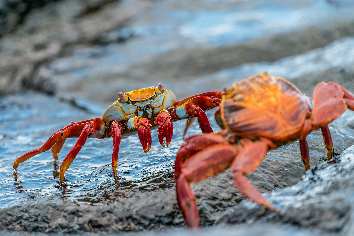
Step into the untouched beauty of the Galápagos Islands—where unique wildlife and pristine landscapes come together in a natural wonderland. Photo by Rod Long on Unsplash.
Ushuaia, Argentina—Journey to the Southernmost City and Gateway to Antarctica
Ushuaia, often called the “End of the World,” is the southernmost city in Argentina and a gateway to the wild and remote landscapes of Tierra del Fuego. Nestled between the Andes mountains and the Beagle Channel, Ushuaia offers dramatic scenery with its rugged mountains, pristine waters, and vast wilderness. The city serves as a starting point for Antarctic expeditions and offers various adventure activities such as trekking, sailing, and wildlife viewing.
Visitors can explore the nearby Tierra del Fuego National Park, which features stunning landscapes, including forests, lakes, and glaciers. Ushuaia’s unique position also makes it an ideal spot for observing the Southern Hemisphere’s celestial wonders. The city’s vibrant waterfront, historic sites, and local museums provide insights into its maritime and exploration history, making it a fascinating destination for those seeking both adventure and cultural enrichment.
Ushuaia Quick Facts:
- Location: Southernmost city in the world, located in Tierra del Fuego, Argentina
- Language: The official language is Spanish. English is not widely spoken, so learning a few basic phrases can be helpful.
- Currency: US Dollar (USD)
- Best Time to Visit: Summer (December to February) offers mild temperatures perfect for hiking and outdoor activities, while winter (June to August) is the ideal season for snow sports like skiing and snowboarding.
- Climate: In summer, temperatures range from 5°C to 15°C (41°F to 59°F) with long daylight hours, while winter sees temperatures between -2°C to 5°C (28°F to 41°F) with shorter daylight and frequent snow.
- Transportation: Ushuaia-Malvinas Argentinas International Airport (USH) serves as the main airport, with local transportation options including taxis, rental cars, and buses. Walking is also a common way to get around the city.
- Safety: While generally safe, it’s important to be cautious of changing weather conditions, especially outdoors, where sudden shifts can occur; it’s recommended to wear layers and carry waterproof gear.
- Top Tourist Attractions: Must-see attractions include Tierra del Fuego National Park, the Beagle Channel, the End of the World Train, Martial Glacier, and the Museo del Fin del Mundo.
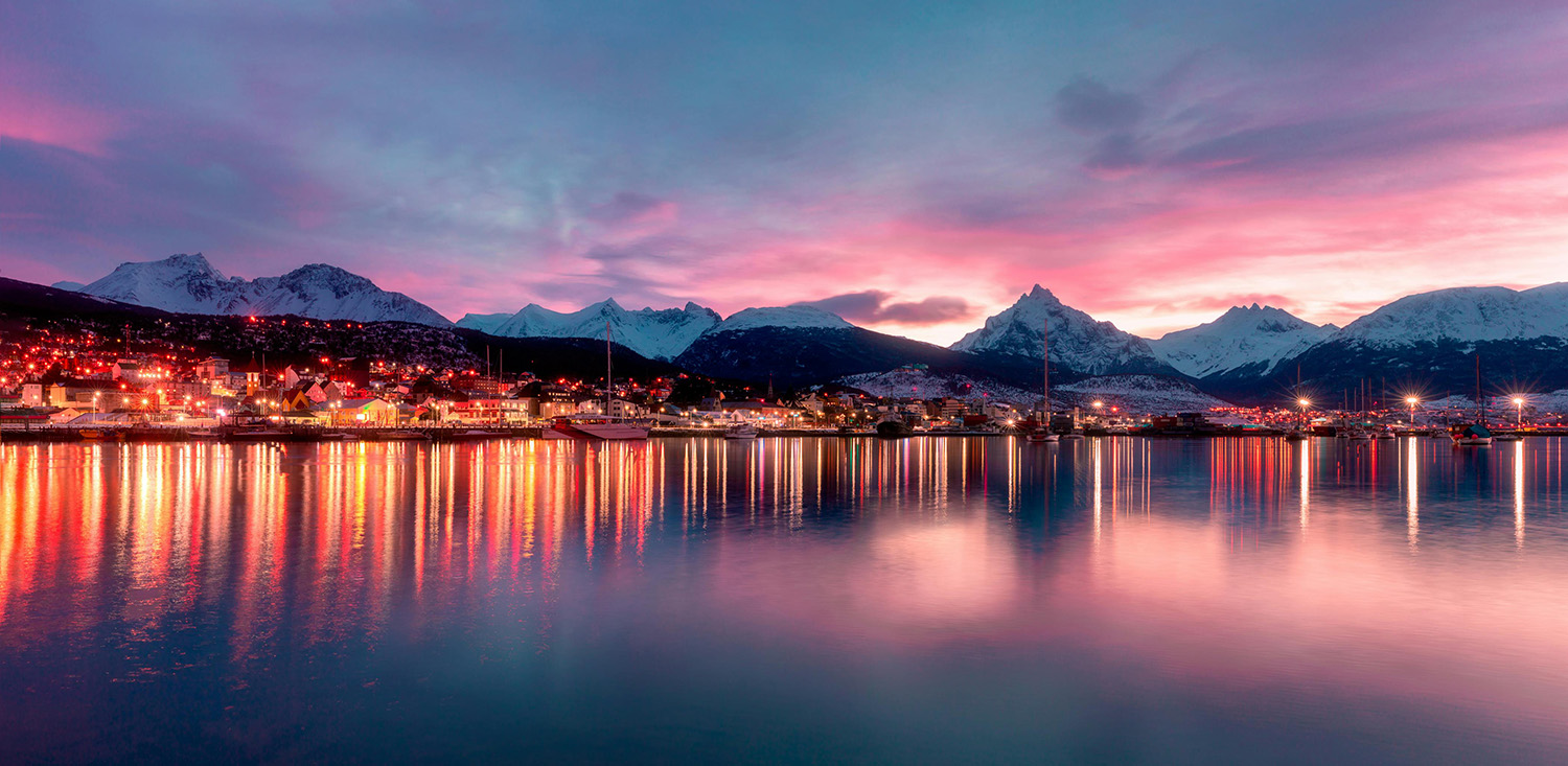
Discover the rugged beauty of Ushuaia—where the end of the world meets breathtaking landscapes and endless adventure. Photo by Francisco Paez on Pexels.
Cusco, Peru—The Historic Gateway to the Inca Empire
Cusco, the historic capital of the Inca Empire, is renowned for its rich cultural heritage and stunning architecture. Nestled in the Andes Mountains, Cusco serves as a gateway to the Sacred Valley and Machu Picchu, drawing travelers eager to explore its ancient ruins and vibrant history.
The city is a blend of Inca and colonial Spanish influences evident in its cobblestone streets, colonial churches, and archaeological sites. Key attractions include the Plaza de Armas, the heart of Cusco’s historic district; the Qorikancha (Temple of the Sun); and the Sacsayhuamán fortress, known for its impressive stone walls.
Cusco’s lively markets, such as San Pedro Market, and its bustling neighborhoods, like San Blas, offer a taste of local culture and artisanal crafts. The city’s rich history and vibrant atmosphere make it a captivating destination for those interested in exploring Peru’s ancient past and vibrant present.
Cusco Quick Facts:
- Location: Southeastern Peru, in the Andes Mountains.
- Language: Spanish is the official language, with Quechua also widely spoken.
- Currency: Peruvian Sol (PEN).
- Best Time to Visit: May to September (dry season) for ideal weather, especially for outdoor activities and trekking.
- Climate: Mild climate with dry winters and rainy summers. Temperatures range from 5°C to 20°C (41°F to 68°F).
- Transportation: Taxis, buses, and walking are common ways to get around. Cusco also has a small airport for domestic flights.
- Safety: Generally safe, but it’s wise to be cautious with your belongings, especially in tourist areas.
Top Tourist Attractions: Must-see attractions in Cusco include the ancient fortress of Sacsayhuamán, the historic Plaza de Armas, the Qorikancha Temple of the Sun, and the charming San Blas Neighborhood.
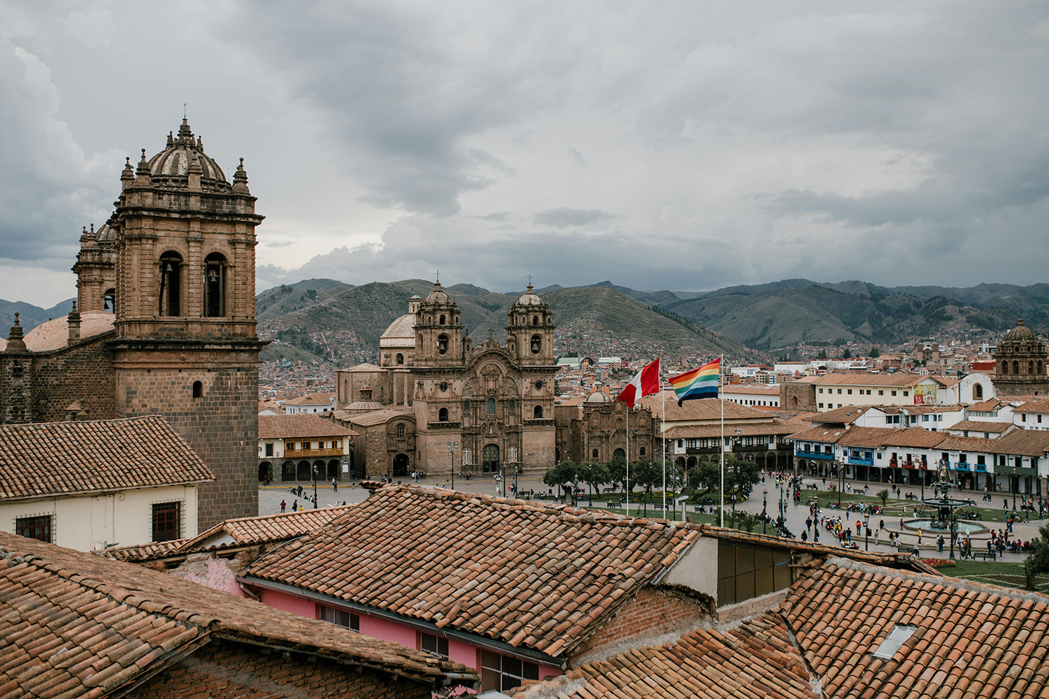
Immerse yourself in the timeless beauty of Cusco—where ancient Inca heritage meets vibrant Andean culture. Photo by Julia Volk on Pexels.
Iguazu Falls, Argentina & Brazil—The Majestic Waterfalls of South America
Iguazu Falls, one of the most spectacular natural wonders in the world, straddles the border between Argentina and Brazil. This magnificent waterfall system consists of over 270 cascades, stretching across nearly 3 kilometers (1.9 miles) of lush rainforest. The thunderous roar and mist from the falls create a breathtaking spectacle, drawing visitors from around the globe.
The most iconic section of Iguazu Falls is the “Devil’s Throat,” a U-shaped cascade that plunges 80 meters (262 feet) into the abyss below, creating an awe-inspiring display of nature’s power. Surrounding the falls is the Iguazu National Park, a UNESCO World Heritage Site that boasts rich biodiversity, including rare and endangered species such as jaguars, tapirs, and colorful toucans.
Visitors can explore the falls from various vantage points, including walkways, boat tours, and helicopter rides, each offering unique perspectives of this incredible natural wonder. Whether you’re on the Argentine or Brazilian side, Iguazu Falls promises an unforgettable experience of raw beauty and grandeur.
Iguazu Falls Quick Facts:
- Location: Straddles the border between Argentina and Brazil, with both countries offering access to the falls.
- Best Time to Visit: April to June and August to September, when water levels are high but crowds are smaller.
- Climate: Subtropical climate; expect hot and humid conditions, with frequent rain, especially during the summer months.
- Getting There: Fly into Cataratas del Iguazú International Airport (Argentina) or Foz do Iguaçu International Airport (Brazil); buses and taxis are available to reach the falls.
- Entry: Two main entrances—Puerto Iguazú (Argentina) and Foz do Iguaçu (Brazil); both offer unique views and experiences.
- Wildlife: Home to diverse species, including monkeys, coatis, toucans, and butterflies; be prepared for wildlife encounters.
- Safety: Stay on designated paths, be cautious near the edge of the falls, and keep an eye on your belongings as coatis are known to snatch food.
- Visas: Check visa requirements depending on your nationality and the side of the falls you plan to visit.
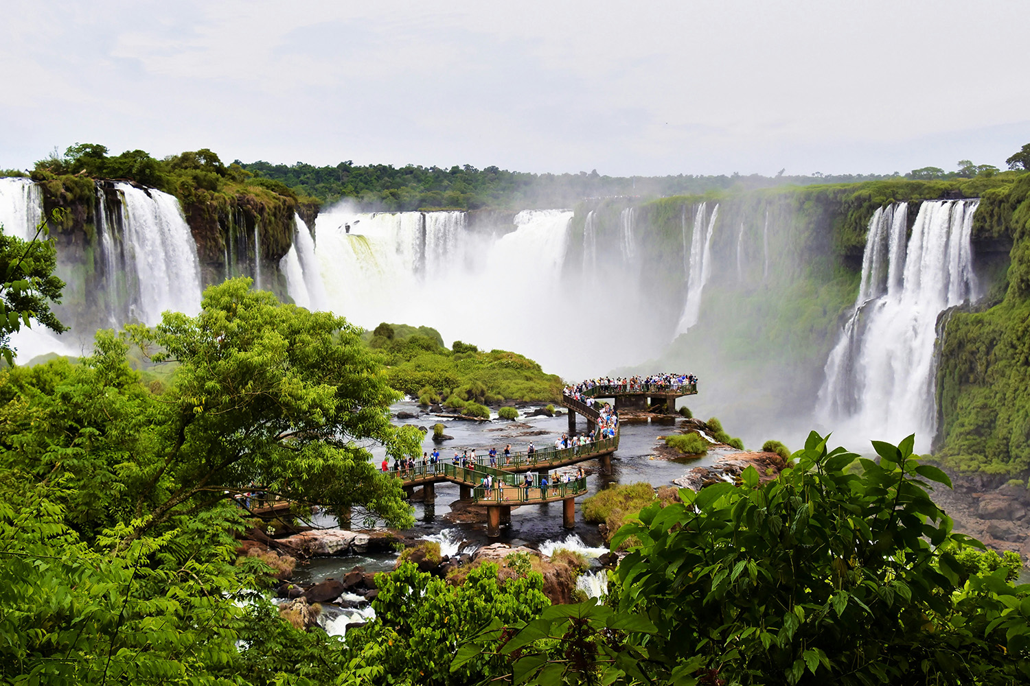
Feel the power of nature at Iguazu Falls—where over 270 cascades create a breathtaking spectacle of water, mist, and rainforest magic. Photo by Jeffrey Eisen on Unsplash.
Easter Island, Chile—Unveiling the Mysteries of Rapa Nui
Easter Island, known as Rapa Nui to its indigenous people, is a remote volcanic island in the Pacific Ocean, famous for its mysterious Moai statues. This UNESCO World Heritage Site is one of the most isolated inhabited places on Earth. The island’s iconic stone statues, with their oversized heads, were carved by the Rapa Nui people between the 13th and 16th centuries and are believed to represent the ancestors of the island’s inhabitants.
Easter Island’s unique cultural and archaeological significance, combined with its stunning landscapes of rolling hills, extinct volcanoes, and pristine beaches, make it a captivating destination for travelers. Visitors can explore the island’s archaeological sites, hike to the top of the Rano Kau volcano, and learn about the rich history and traditions of the Rapa Nui people at the island’s museums and cultural centers.
Whether you’re marveling at the Moai statues, diving in the crystal-clear waters, or simply taking in the island’s serene beauty, Easter Island offers a truly unique and unforgettable experience.
Easter Island Quick Facts:
- Location: In the southeastern Pacific Ocean, over 3,500 kilometers (2,200 miles) west of Chile.
- Language: Spanish and Rapa Nui (the indigenous language).
- Currency: Chilean Peso (CLP).
- Best Time to Visit: April to June and October to December offer a balance of good weather, fewer crowds, and lower prices, making them the best times to visit Easter Island.
- Climate: Subtropical climate with mild temperatures year-round; expect warm summers and cooler winters.
- Getting There: Flights available from Santiago, Chile, to Mataveri International Airport (IPC).
- Top Attractions: Moai statues, Rano Raraku quarry, Ahu Tongariki, Rano Kau volcano, Orongo ceremonial village, Anakena Beach.
- Culture: Rich Polynesian heritage with unique traditions, dances, and music; Tapati Rapa Nui festival is a major cultural event.
- Entry Requirements: Check visa requirements based on your nationality; entry fees apply to Rapa Nui National Park.
- Safety: Generally safe, but be mindful of remote locations and respect cultural sites; limited medical facilities, so travel insurance is recommended.
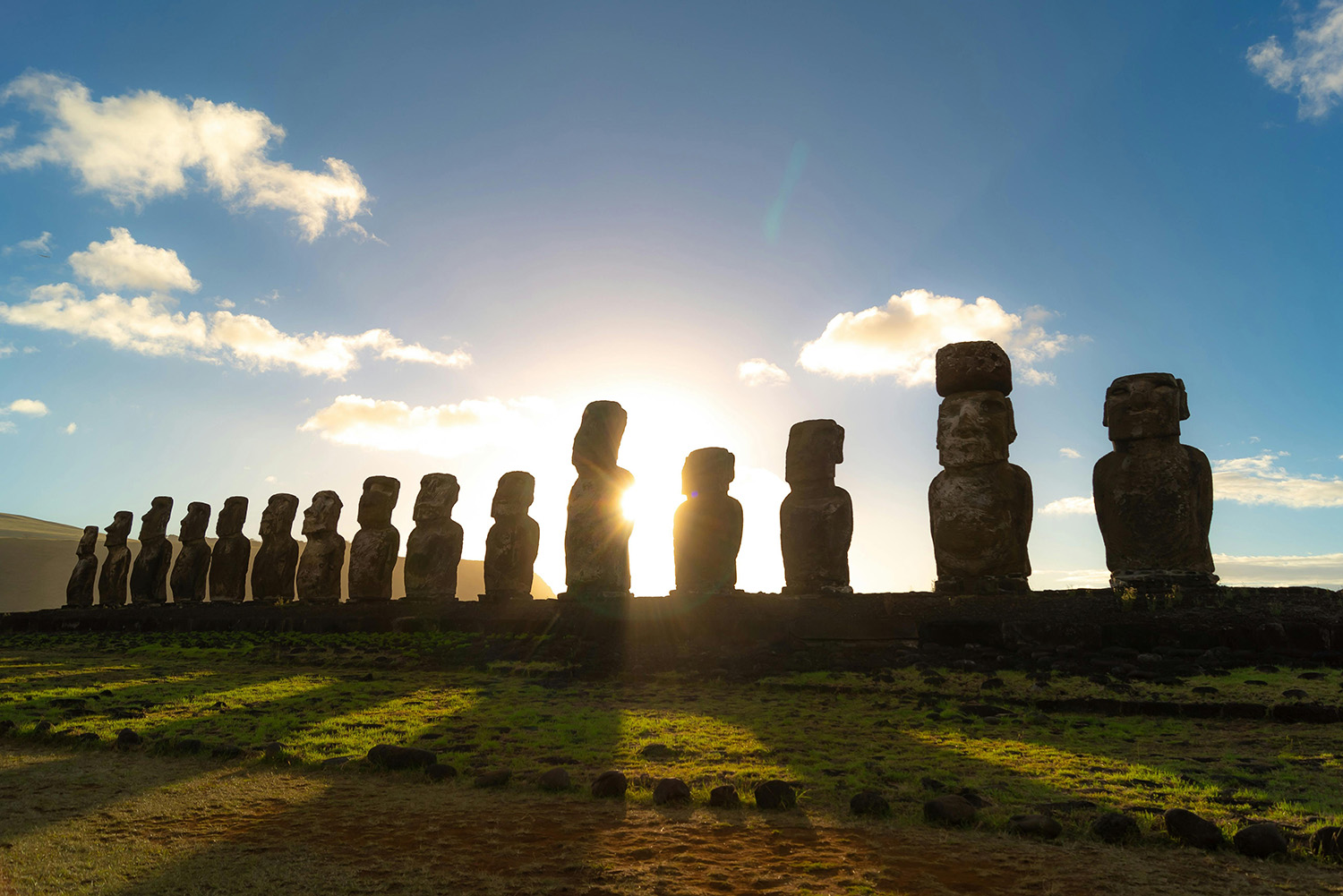
Where history and mystery meet—Easter Island’s timeless guardians. Photo by Andrea Vera Sasso on Pexels.
Atacama Desert, Chile—Exploring the World’s Driest Desert
The Atacama Desert is the driest non-polar desert in the world and a landscape of otherworldly beauty. Spanning over 100,000 square kilometers (40,000 square miles), the desert is known for its surreal landscapes, including salt flats, active geysers, rugged canyons, and towering sand dunes. The Atacama is also famous for its incredibly clear skies, making it one of the best places on Earth for stargazing.
Despite its harsh conditions, the Atacama Desert is home to a variety of unique flora and fauna, as well as ancient archaeological sites left by the indigenous Atacameño people. Visitors can explore the stunning Valle de la Luna (Moon Valley), the eerie Tatio Geysers, and the vast salt flats of Salar de Atacama, where flamingos can often be seen wading in the shallow waters. The desert’s charming oases towns, like San Pedro de Atacama, serve as a base for exploring the region and offer a glimpse into local culture and traditions.
The Atacama Desert’s unique blend of natural beauty, extreme environment, and cultural heritage make it a must-visit destination for adventurers, photographers, and anyone seeking to experience one of the most extraordinary places on the planet.
Atacama Desert Quick Facts:
- Location: Northern Chile, spanning over 100,000 square kilometers (40,000 square miles).
- Best Time to Visit: March to May and September to November, when temperatures are milder and conditions are ideal for outdoor activities.
- Climate: Extremely dry with minimal rainfall; temperatures vary greatly between day and night. Daytime temperatures can reach up to 25°C (77°F) while nighttime temperatures can drop below freezing.
- Getting There: Fly into Calama Airport (CJC) and transfer to San Pedro de Atacama, the main gateway to the desert.
- Top Attractions: Valle de la Luna (Moon Valley), Tatio Geysers, Salar de Atacama, El Tatio hot springs, and the high-altitude observatories for stargazing.
- Altitude: The region includes high-altitude areas; acclimate to prevent altitude sickness.
- What to Bring: Sun protection (sunscreen, hat, sunglasses), warm layers for cold nights, and plenty of water.
- Safety: Generally safe for travelers, but be prepared for extreme weather conditions and limited medical facilities; travel insurance is recommended.
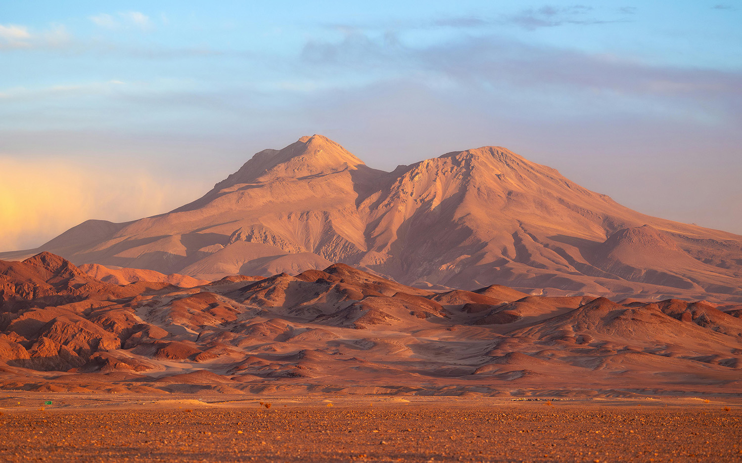
Explore the otherworldly beauty of the Atacama Desert. Photo by Marek Piwnicki on Pexels.
Quito, Ecuador—Discover the Charm of Ecuador’s Historic Capital
Quito, the capital of Ecuador, is a city steeped in history and surrounded by dramatic Andean landscapes. Nestled at an altitude of about 2,850 meters (9,350 feet) above sea level, it is one of the highest capital cities in the world. Quito boasts a beautifully preserved colonial center, which is a UNESCO World Heritage Site, known for its stunning architecture, historic churches, and vibrant plazas.
The city’s landmark attractions include the Basilica del Voto Nacional, the Church of San Francisco, and the picturesque Plaza Grande. The Panecillo Hill offers panoramic views of Quito and the surrounding volcanoes. Quito is also a gateway to exploring nearby natural wonders, including the lush cloud forests and the famous “Middle of the World” monument, where visitors can stand on the equatorial line.
With its rich cultural heritage, lively markets, and diverse culinary scene, Quito provides an enriching experience for travelers seeking to immerse themselves in Ecuadorian history and natural beauty.
Quito Quick Facts:
- Location: The capital of Ecuador is located in the Andean highlands at about 2,850 meters (9,350 feet) above sea level.
- Language: The official language spoken in Quito is Spanish. In addition to Spanish, some indigenous languages, such as Kichwa (a Quechuan language), are also spoken by various communities.
- Currency: United States Dollar (USD).
- Best Time to Visit: April to October, when the weather is relatively dry and sunny.
- Climate: Mild temperatures year-round, ranging from 10°C to 20°C (50°F to 68°F); weather can change quickly due to the city’s high altitude.
- Transportation: Taxis, buses, and rideshare services are available. Walking is also common in the city center.
- Safety: Generally safe for tourists, but exercise standard precautions and be aware of your surroundings, especially in crowded areas.
- Top Tourist Attractions: Historic Center (UNESCO World Heritage Site), Basilica del Voto Nacional, Church of San Francisco, La Ronda neighborhood, Panecillo Hill, Mitad del Mundo (Middle of the World monument).
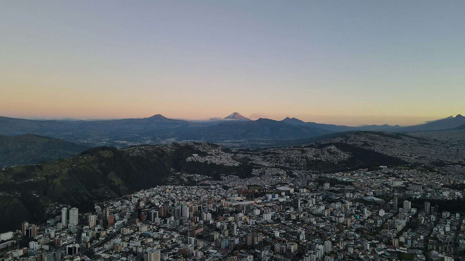
Stunning Quito—Where colonial charm meets breathtaking mountain views. Photo by Esteban Ponce.
Perito Moreno Glacier, Argentina—Marvel at Patagonia’s Ice Spectacle
Perito Moreno Glacier, located in Argentina’s Los Glaciares National Park in Patagonia, is one of the most spectacular and accessible glaciers in the world. Stretching over 250 square kilometers (97 square miles) and reaching heights of up to 74 meters (240 feet) above the surface of Lake Argentino, this massive ice formation is renowned for its dramatic ice calving events, where chunks of ice break off and crash into the lake.
The glacier is a dynamic, advancing glacier, meaning it is continuously growing, unlike many other glaciers around the world that are retreating. Its bright blue ice and creaking, shifting icebergs create a stunning visual and auditory experience for visitors.
Key attractions include the extensive network of walkways and viewing platforms that provide various perspectives of the glacier and its surrounding landscapes. Guided tours and boat excursions offer close-up views of the glacier’s face, and for the adventurous, ice trekking experiences allow visitors to explore the glacier’s surface.
Perito Moreno Glacier is a UNESCO World Heritage Site and a must-visit destination for nature lovers and those seeking to witness the raw power and beauty of glacial landscapes.
Perito Moreno Glacier Quick Facts:
- Location: Los Glaciares National Park, Patagonia, Argentina.
- Best Time to Visit: November to March, during the Southern Hemisphere’s summer, when weather conditions are more favorable for viewing and outdoor activities.
- Climate: Variable climate with cool temperatures; daytime temperatures can range from 10°C to 20°C (50°F to 68°F). Be prepared for strong winds and sudden changes in weather.
- Getting There: Fly into El Calafate Airport (FTE), the nearest town, and then travel by bus or car to the glacier, approximately 80 kilometers (50 miles) away.
- Top Attractions: Viewing platforms with panoramic views, boat tours close to the glacier face, ice trekking excursions on the glacier’s surface.
- Entry Requirements: Access to the glacier requires an entry fee to Los Glaciares National Park.
- What to Bring: Warm clothing, sturdy footwear, sun protection (sunscreen, hat, sunglasses), and a camera to capture the stunning scenery.
- Safety: Follow park guidelines and stay on designated paths; ice can be slippery and weather conditions can change rapidly.
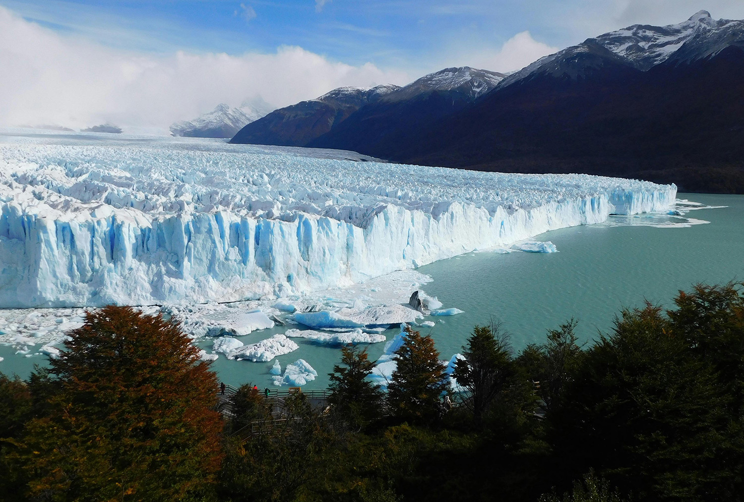
Experience the breathtaking beauty of the Perito Moreno Glacier—a stunning frozen expanse where nature’s power and majesty are on full display. Photo by Maxi Dorado on Pexels.
Lima, Peru—Experience the Vibrant Heart of Peru
Lima, the bustling capital of Peru, is a vibrant metropolis situated on the central coast overlooking the Pacific Ocean. Known for its rich history and diverse culture, Lima offers a dynamic blend of historical and modern attractions. The city is renowned for its exceptional gastronomy, with numerous restaurants showcasing both traditional Peruvian dishes and innovative fusion cuisine.
Key attractions include the historic center, a UNESCO World Heritage site with colonial architecture such as the Plaza Mayor and the Cathedral of Lima, as well as the lively Miraflores district with its upscale shops and scenic coastal views. The bohemian neighborhood of Barranco is famous for its street art and vibrant nightlife.
Whether you’re exploring local markets, surfing along the coast, or delving into Peru’s rich history at museums like the Larco Museum, Lima serves as an essential gateway to other Peruvian destinations, including the Sacred Valley and Machu Picchu.
Lima Quick Facts:
- Location: Lima is located on the central coast of Peru, along the Pacific Ocean.
- Language: The official language is Spanish. Quechua and Aymara are also spoken.
- Currency: The currency is the Peruvian Sol (PEN).
- Best Time to Visit: The best time to visit is from December to April, during the summer months when the weather is warmer and drier.
- Climate: Lima has a mild desert climate with temperatures averaging between 60-80°F (15-27°C). It is generally foggy and drizzly from June to October.
- Transportation: The city is served by Jorge Chávez International Airport. Local transportation includes taxis, buses, and the Lima Metro.
- Safety: Lima is generally safe for tourists, but it’s wise to stay vigilant, avoid isolated areas at night, and use reputable transportation options.
- Top Tourist Attractions: Key attractions include the historic center (Plaza Mayor, Cathedral of Lima), Miraflores district, Barranco neighborhood, Larco Museum, and the Parque Kennedy.
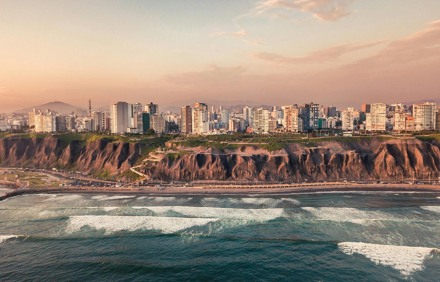
xplore the vibrant cityscape of Lima, where colonial charm meets modern energy along the stunning Pacific coastline. Photo by Willian Justen de Vasconcellos on Pexels.
Lake Titicaca, Peru & Bolivia—Discover the World’s Highest Navigable Lake
Lake Titicaca is the highest navigable lake in the world, situated at an altitude of approximately 3,812 meters (12,507 feet). Covering around 8,372 square kilometers (3,232 square miles), this expansive lake is renowned for its deep blue waters, cultural significance, and unique archaeological sites. It holds a sacred place in Andean culture, particularly for the Quechua and Aymara people, and is considered the cradle of Inca civilization.
The lake is dotted with fascinating islands, each offering its own attractions. The Uros Islands, made of totora reeds, are floating islands inhabited by the Uros people, where visitors can experience traditional crafts and lifestyle. Taquile Island is known for its traditional weaving and agricultural practices, while Amantaní Island offers a more remote experience with traditional village life and stunning views.
Puno, the principal city on the Peruvian side, acts as a gateway for visitors and is famed for its lively festivals, including the Fiesta de la Candelaria. The lake’s vast expanse and surrounding highland landscapes create breathtaking views and a serene atmosphere. Activities such as boat tours, hiking, and cultural immersion allow visitors to explore the rich heritage and natural beauty of Lake Titicaca, making it a unique and enriching destination.
Lake Titicaca Quick Facts:
- Location: Straddles the border between Peru and Bolivia, in the Andean highlands.
- Altitude: Approximately 3,812 meters (12,507 feet) above sea level.
- Altitude Sickness: Be aware of the effects of high altitude; symptoms can include dizziness, shortness of breath, and headaches. It’s advisable to acclimate slowly and stay hydrated.
- Best Time to Visit: May to October, during the dry season, when the weather is more stable and pleasant.
- Climate: Daytime temperatures range from 10°C to 20°C (50°F to 68°F), while nighttime temperatures can drop below freezing. Be prepared for strong sunlight and potential cold temperatures at night.
- Getting There: The city of Puno in Peru and the town of Copacabana in Bolivia are common entry points. Puno can be reached by bus from Cusco or by flight to the nearby Inca Manco Cápac International Airport (JUL).
- Top Attractions: Uros Islands (floating islands made of totora reeds), Taquile Island (known for traditional weaving), Amantaní Island (remote village life), and Puno City (gateway with vibrant festivals).
- Cultural Tips: Respect local customs and traditions, particularly when visiting indigenous communities. Traditional dress and practices are an integral part of the cultural experience.
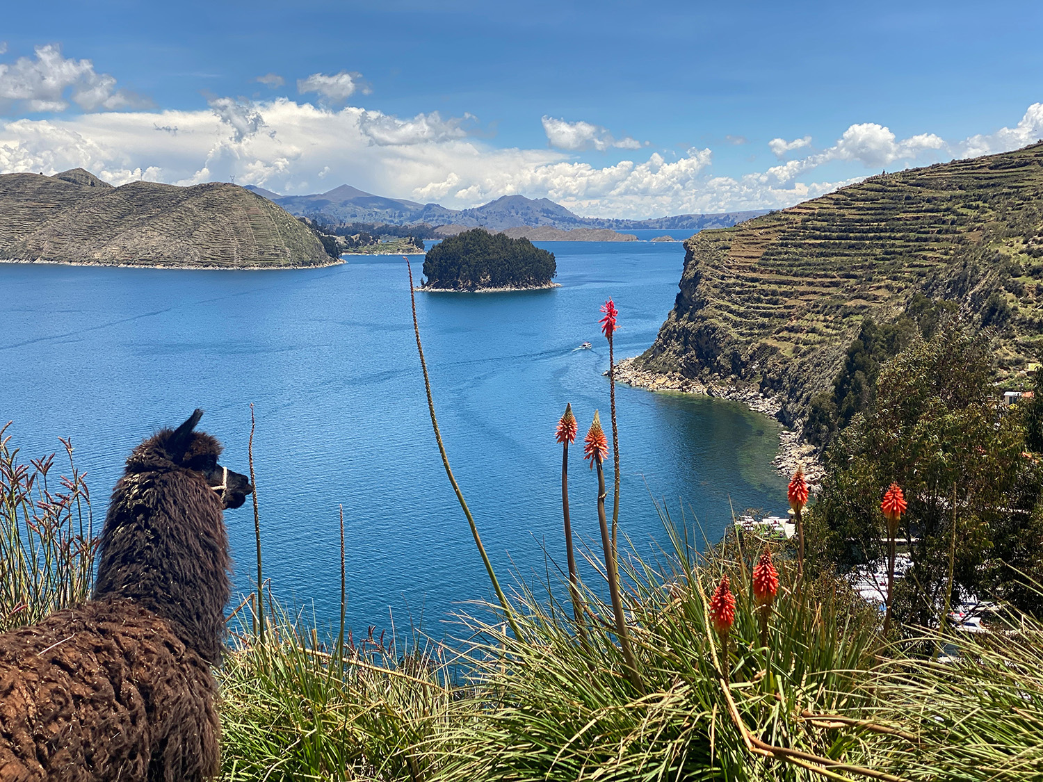
Where the sky meets the sacred waters—Lake Titicaca’s timeless beauty. Photo by EEJCC, under the CC BY-SA 4.0 <https://creativecommons.org/licenses/by-sa/4.0> license, via Wikimedia Commons.
Pantanal, Brazil—Brazil’s Wildlife Wonderland
The Pantanal is the world’s largest tropical wetland and a hotspot of biodiversity. Covering over 150,000 square kilometers (57,000 square miles), this expansive floodplain is renowned for its remarkable variety of wildlife and stunning natural landscapes. The Pantanal supports a diverse array of flora and fauna, including jaguars, capybaras, giant river otters, caimans, and over 650 bird species such as the hyacinth macaw and the jabiru stork.
The region’s unique seasonal flooding creates a dynamic landscape of wetlands, lagoons, and grasslands, influencing its ecological balance and wildlife patterns. This seasonal cycle not only supports diverse habitats but also enhances wildlife viewing opportunities, making the Pantanal a prime destination for nature enthusiasts and photographers.
Ecotourism plays a crucial role in preserving the Pantanal’s delicate environment. Responsible travel practices and conservation efforts are emphasized through eco-lodges and guided tours, promoting sustainable interaction with the region’s rich biodiversity. With its tropical climate characterized by distinct wet and dry seasons, the Pantanal offers exceptional experiences throughout the year, though the dry season (April to October) is particularly favored for wildlife viewing and exploration. This vast and diverse wetland promises an immersive experience in one of the world’s most extraordinary natural environments.
Pantanal Quick Facts:
- Location: Spans Brazil and extends into Bolivia and Paraguay.
- Size: Covers over 150,000 square kilometers (57,000 square miles).
- Best Time to Visit: Dry season from April to October for better wildlife viewing and accessibility. The wet season from November to March brings heavy rains and extensive flooding.
- Climate: Tropical climate with distinct wet and dry seasons. Temperatures range from 25°C to 35°C (77°F to 95°F) year-round. Expect high humidity and potential rainfall, especially during the wet season.
- Wildlife Viewing: Home to jaguars, capybaras, giant river otters, caimans, and over 650 bird species. Early morning and late afternoon are optimal times for wildlife sightings.
- Activities: Wildlife safaris, boat tours, canoe trips, and walking excursions. Photography and birdwatching are popular.
- Health Precautions: Vaccinations for yellow fever, hepatitis A, and B may be recommended. Malaria prevention may be necessary; consult with a healthcare provider before traveling.
- Access: Main access points are via the cities of Cuiabá and Campo Grande in Brazil. Flights and road transfers are common for reaching lodges and tour bases.
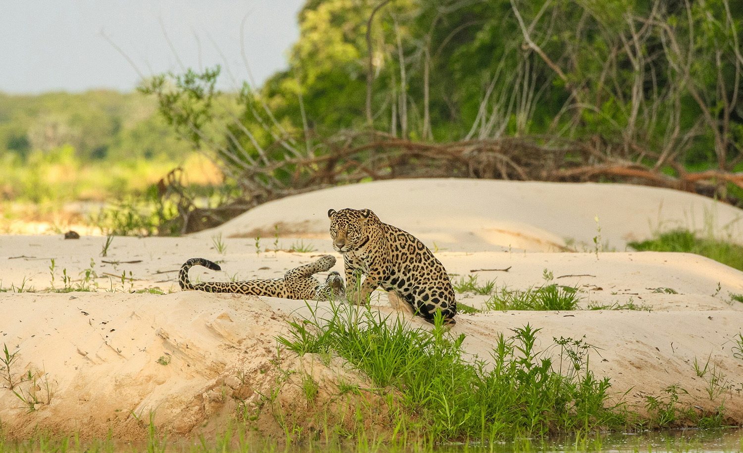
Explore the Pantanal: A breathtaking expanse of wetlands, teeming with vibrant wildlife and lush landscapes. Photo by David Waite on Unsplash.
Mendoza, Argentina—Argentina’s Premier Wine Region
Mendoza, located in the heart of Argentina’s wine country, is renowned for its stunning landscapes, characterized by the majestic Andes mountains and expansive vineyards. As the country’s premier wine-producing region, Mendoza is famous for its Malbec wines, offering numerous opportunities for wine tours and tastings.
The city itself blends urban charm with a laid-back atmosphere, featuring elegant plazas, bustling markets, and a rich culinary scene. Mendoza is also a gateway to outdoor adventures, including hiking, skiing, and mountaineering, making it a destination for both relaxation and exploration.
Mendoza Quick Facts:
- Location: Mendoza is located in the west of Argentina, near the Andes mountains.
- Language: Spanish is the official language.
- Currency: Argentine Peso (ARS).
- Best Time to Visit: The best time to visit Mendoza is from September to April, during the spring and summer months. The harvest season (March-April) is particularly popular.
- Climate: Mendoza has a semi-arid climate with hot summers and mild winters. Temperatures can exceed 30°C (86°F) in summer and drop to around 0°C (32°F) in winter.
- Transportation: Mendoza can be reached by flight, with El Plumerillo Airport serving domestic and international flights. Within the city, taxis, rental cars, and bike rentals are common. Tours often provide transportation to vineyards and nearby attractions.
- Safety: Mendoza is generally considered safe for tourists, but it’s always advisable to stay alert, especially in crowded areas.
- Top Tourist Attractions: Key attractions include the Mendoza wine region with its numerous vineyards and wineries, Aconcagua Mountain (the highest peak in the Andes), and the beautiful Parque General San Martín.
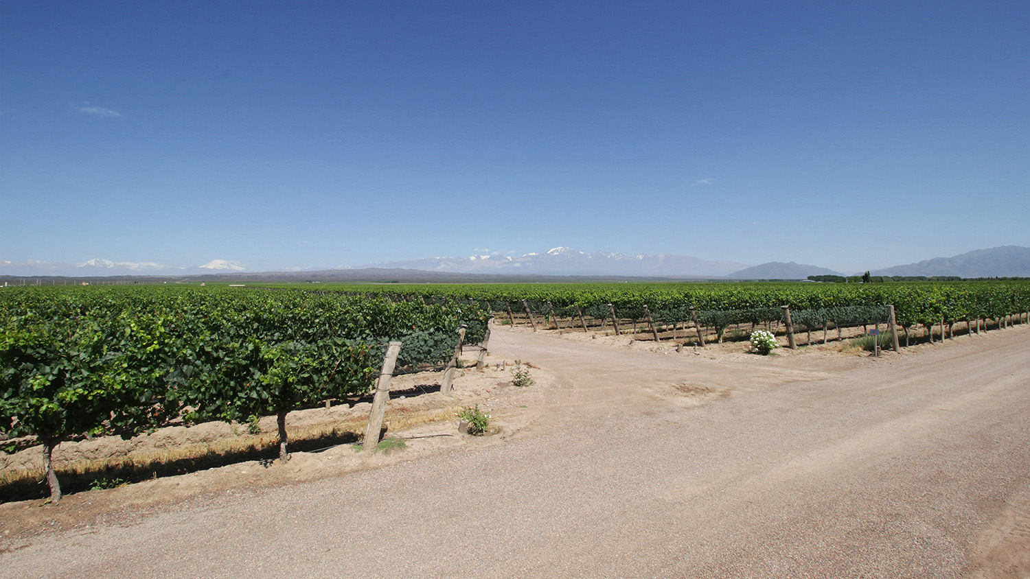
Vast stretches of Mendoza vineyards with the Andes Mountains as a stunning backdrop. Photo by celso costa on Unsplash.
Tierra del Fuego, Argentina & Chile—The End of the World’s Wild Beauty
Tierra del Fuego, an archipelago at the southern tip of South America, is known for its rugged landscapes and dramatic natural beauty. The main island, shared by Chile and Argentina, features diverse terrains, including mountains, glaciers, and fjords.
Ushuaia, the southernmost city in the world, serves as the primary gateway to Tierra del Fuego. Known as the “End of the World,” Ushuaia is a bustling hub for adventure tourism.
Popular activities in Tierra del Fuego include hiking through sub-Antarctic forests, around glacial lakes, and across windswept plateaus for stunning views of the wilderness. Additionally, sailing along the Beagle Channel offers opportunities to observe unique wildlife, such as penguins and sea lions.
The area’s history, rich with indigenous culture and early European exploration, adds to its allure, making Tierra del Fuego a compelling destination for adventurers and nature enthusiasts alike.
Tierra del Fuego Quick Facts:
- Location: Tierra del Fuego is an archipelago at the southern tip of South America, divided between Chile and Argentina.
- Climate: Expect a cold, temperate climate with unpredictable weather, including rain, snow, and strong winds. Pack layered clothing.
- Geography: Known for its dramatic landscapes, including glaciers, mountains, and fjords.
- Language: Spanish is the official language in both Chilean and Argentinean parts of Tierra del Fuego.
- Currency: Chilean Peso (CLP) is used in the Chilean part, while Argentine Peso (ARS) is used in the Argentinean part.
- Travel Access: Ushuaia is the main city in Argentinean Tierra del Fuego, and Punta Arenas is a key city in the Chilean part. Both are accessible by air.
- Activities: Popular activities include hiking, wildlife watching, and exploring national parks like Tierra del Fuego National Park and Parque Nacional Alberto de Agostini.
- Wildlife: Look out for unique species such as the Andean condor, Magellanic penguins, and sea lions.
- Time Zone: Tierra del Fuego is in the Argentina Time Zone (ART) or Chile Time Zone (CLT), depending on the side you are visiting.
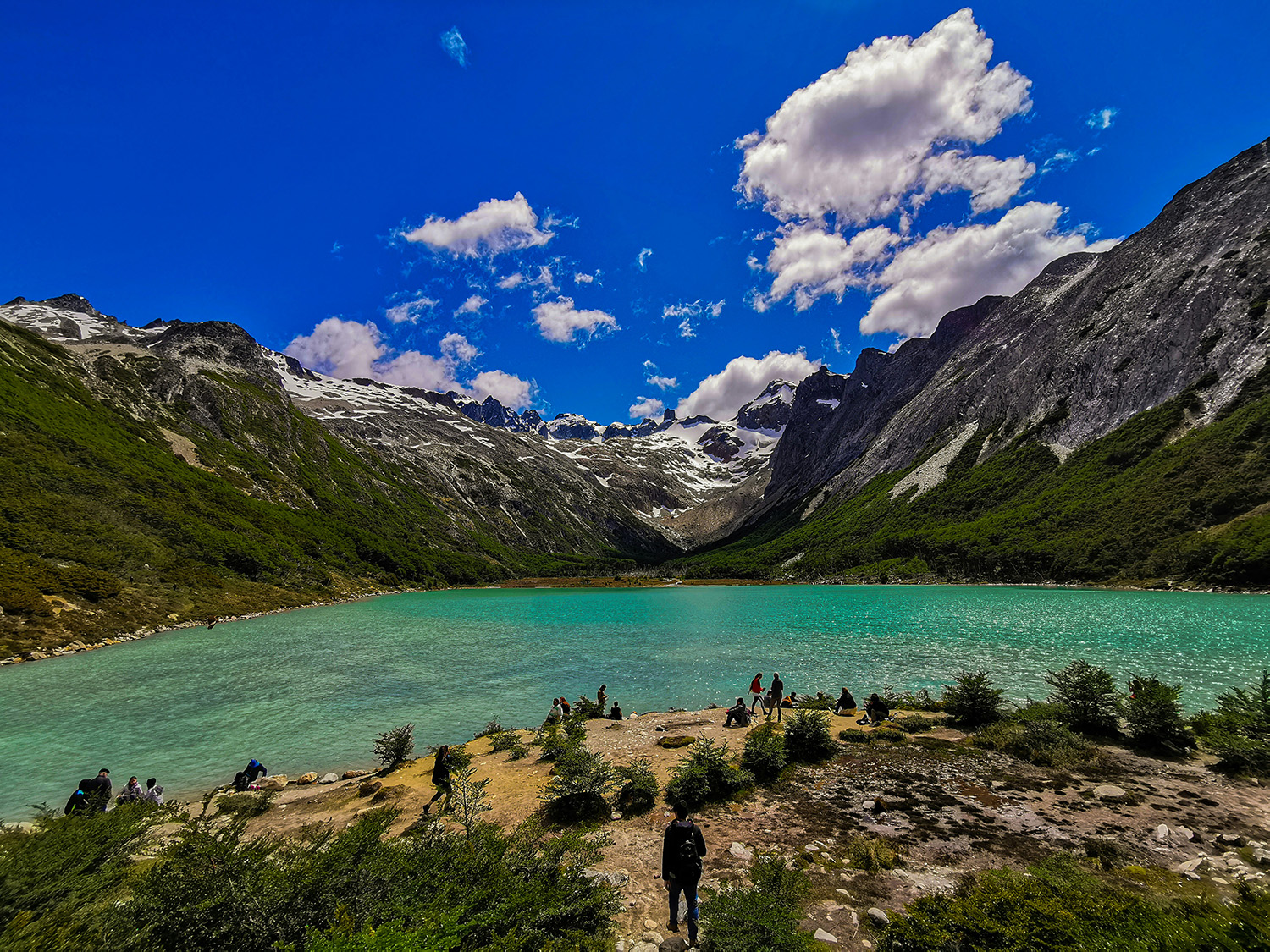
Majestic landscapes of Tierra del Fuego: rugged mountains, glacial lakes, and sweeping windswept plateaus. Photo by Florian Delée on Unsplash.
Valparaíso, Chile—Chile’s Colorful Coastal Gem
Valparaíso, Chile’s colorful port city, captivates with its blend of vibrant culture and historic charm. Perched on a series of hills overlooking the Pacific Ocean, Valparaíso is renowned for its vividly painted houses, charming funiculars, and eclectic artistic scene. The city’s labyrinthine streets, adorned with murals and street art, are a testament to its creative spirit.
As a UNESCO World Heritage Site, Valparaíso boasts a rich maritime history, evident in its well-preserved architecture and bustling port area. The city offers stunning views, from its dramatic coastal cliffs to the bustling marketplaces, making it a unique destination with a blend of history, art, and seafaring heritage.
Valparaíso Quick Facts:
- Location: Situated on the central coast of Chile, about 120 kilometers (75 miles) northwest of Santiago.
- Language: Spanish is the official language. English is not widely spoken, so learning basic Spanish phrases can be helpful.
- Currency: Chilean Peso (CLP). Credit cards are widely accepted, but it’s a good idea to carry some cash for small purchases.
- Best Time to Visit: The best time to visit Valparaíso is during its spring and summer months, from September to March.
- Climate: Mediterranean climate with mild, wet winters and warm, dry summers. Average temperatures range from 10°C (50°F) in winter to 20°C (68°F) in summer.
- Transportation: Accessible via bus or car from Santiago. The city is also reachable by train, but the ride is scenic and not always the fastest option.
- Safety: Valparaíso is generally safe for tourists, but like any major city, be cautious with your belongings and avoid isolated areas at night.
- Top Tourist Attractions: Key highlights include historic funiculars, colorful hilltop neighborhoods like Cerro Alegre and Cerro Concepción, and the Museo de Bellas Artes.
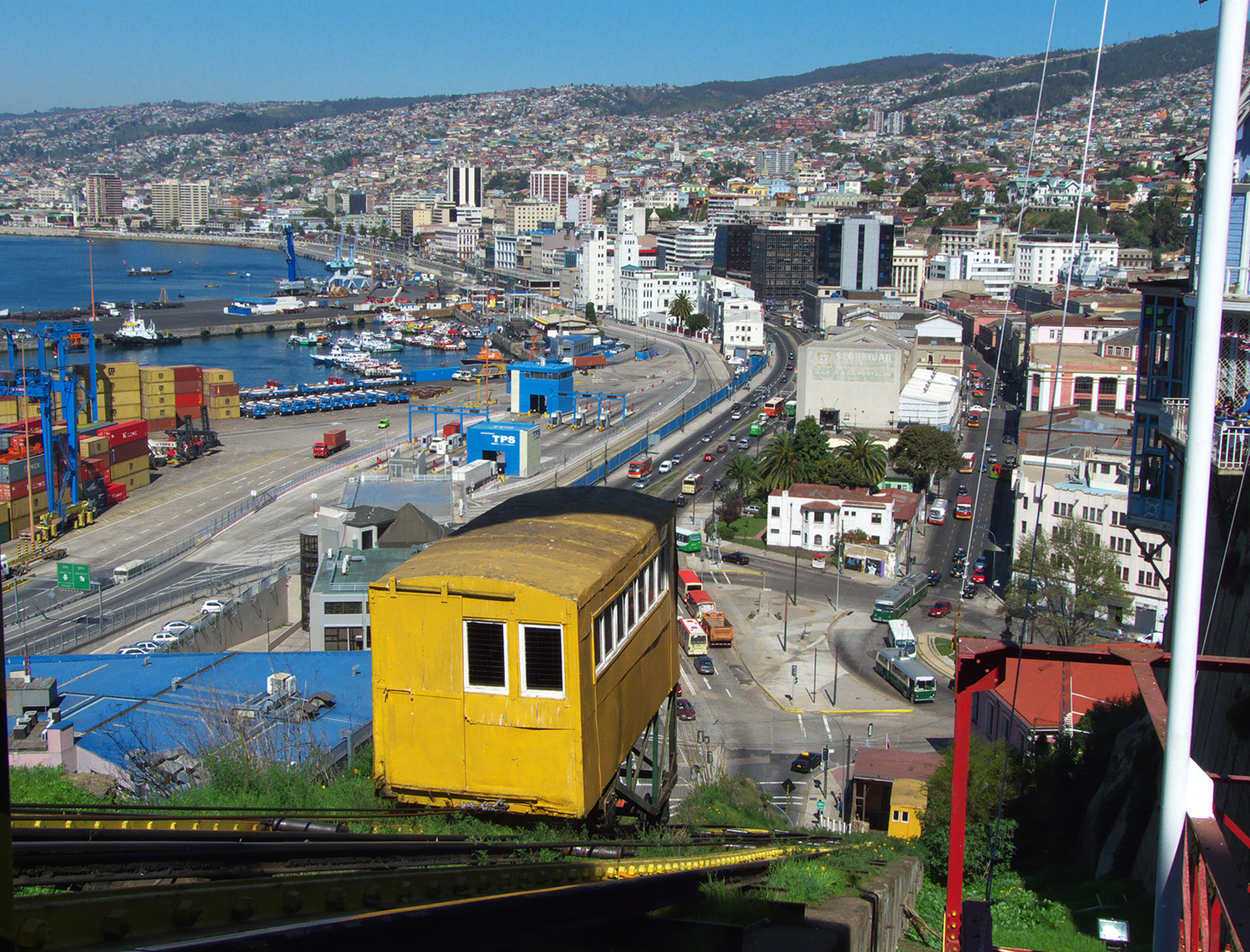
Valparaíso’s iconic funiculars offer stunning views as they climb the city’s colorful hills, blending history and beauty in every ascent. Photo by Javier Rubilar from Santiago, Chile, under the CC BY-SA 2.0 <https://creativecommons.org/licenses/by-sa/2.0> license, via Wikimedia Commons.
La Paz, Bolivia—Bolivia’s High-Altitude Capital
La Paz, the administrative capital of Bolivia, is a city like no other. Nestled in a deep valley, it is one of the highest capitals in the world. Surrounded by the towering peaks of the Andes, including the iconic Illimani mountain, La Paz offers breathtaking views and a unique urban landscape that winds through steep hills and narrow streets.
The city’s rich cultural heritage is reflected in its architecture, where colonial-era buildings stand alongside vibrant indigenous markets. La Paz is a melting pot of cultures, with a strong indigenous presence that influences everything from language to cuisine.
The city is also famous for its impressive cable car system, the Teleférico, which provides not only a practical mode of transportation but also stunning aerial views of the city. For those seeking adventure, La Paz serves as a gateway to some of Bolivia’s most spectacular natural attractions.
Whether you’re interested in history, culture, or adventure, La Paz offers a diverse and unforgettable experience in the heart of the Andes.
La Paz Quick Facts:
- Location: La Paz is located in western Bolivia, nestled in a deep valley surrounded by the Andes Mountains.
- Elevation: 3,650 meters (11,975 feet) above sea level, making it one of the highest capitals in the world.
- Language: Spanish is the official language, but many locals also speak Aymara and Quechua.
- Currency: Bolivian Boliviano (BOB).
- Best Time to Visit: May to October, during the dry season, when the weather is more stable and ideal for exploring.
- Climate: Cool year-round due to the high altitude, with temperatures averaging 6-18°C (43-64°F). The dry season runs from May to October, while the wet season is from November to April.
- Transportation: The Teleférico cable car system is an efficient and scenic way to get around the city. Taxis and minibuses are also commonly used.
- Safety: While generally safe, like any major city, it’s advisable to be cautious with personal belongings and avoid poorly lit areas at nigh
- t.
- Top Tourist Attractions: Plaza Murillo, Witches’ Market, the Teleférico, Moon Valley, and nearby excursions like the Death Road for adventure seekers.
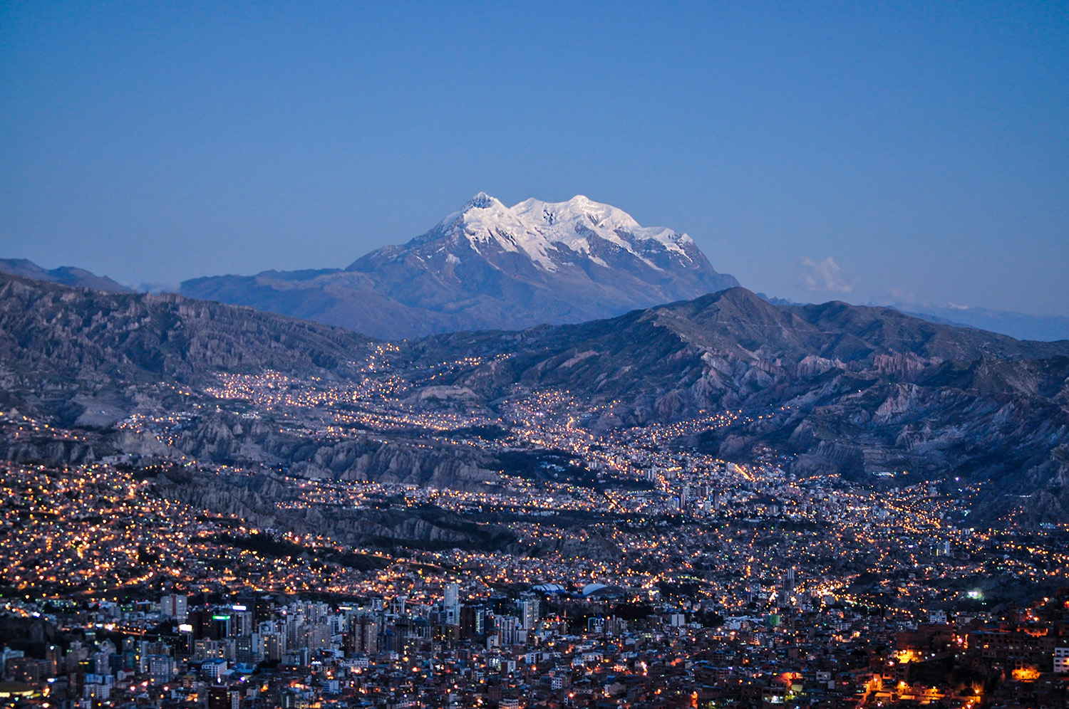
Experience the breathtaking beauty of La Paz, the world’s highest capital city. Photo by EEJCC, under the CC BY-SA 4.0 <https://creativecommons.org/licenses/by-sa/4.0> license, via Wikimedia Commons.
Sacred Valley, Peru—Peru’s Enchanting Heartland
The Sacred Valley, or Valle Sagrado, is a stunning region in Peru, renowned for its rich history and breathtaking landscapes. Nestled between the Andean peaks and the Urubamba River, this valley was an important cultural and agricultural hub for the Inca Empire.
Visitors are captivated by its lush terraced fields, picturesque villages, and ancient ruins. Key highlights include the impressive ruins of Ollantaytambo, an ancient Inca fortress with expansive terraces and panoramic views, and the vibrant town of Pisac, known for its bustling market and extensive archaeological site. The valley is also home to the picturesque town of Urubamba, serving as a gateway to exploring the surrounding natural beauty and historical sites.
The Sacred Valley offers a blend of stunning natural beauty and cultural richness, with opportunities for hiking, exploring traditional Andean villages, and discovering the ancient Inca heritage that defines this enchanting region.
Sacred Valley Quick Facts:
- Location: Situated between Cusco and Machu Picchu.
- Altitude: Ranges from approximately 2,800 to 3,200 meters (9,200 to 10,500 feet) above sea level.
- Altitude Sickness: Stay hydrated and consider taking altitude sickness medication.
- Best Time to Visit: Best visited during the dry season from May to September for optimal weather.
- Climate: Subtropical highland climate.
- Top Tourist Attractions: Ollantaytambo, Pisac, Urubamba, Moray, Salinas de Maras, Chinchero, Qenqo, Tambomachay, Pisaq Ruins, Inti Raymi Festival
- Activities: Hiking, exploring Inca ruins, visiting traditional markets, and experiencing local Andean culture.
- Transportation: Accessible by train, bus, or private car from Cusco.
- Accommodations: Ranges from luxury lodges to budget hostels.
- Local Culture: Respect local customs and traditions; try traditional Andean dishes.
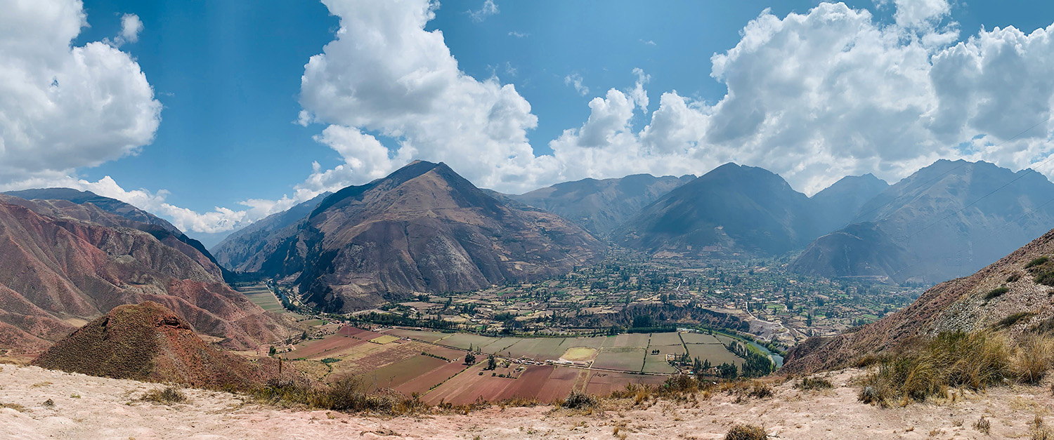
Majestic views of the Sacred Valley, where ancient Inca ruins blend seamlessly with breathtaking landscapes and vibrant local culture. Photo by Paul Daly on Unsplash.
Amazon Rainforest, Brazil, Peru, Ecuador, Bolivia— Discover the Lungs of the Earth
The Amazon Rainforest, commonly known as the “lungs of the Earth,” is the largest tropical rainforest on the planet, covering more than 5.5 million square kilometers and extending across nine South American countries.
Known for its incredible biodiversity, the Amazon is home to millions of species of plants, animals, and insects, many of which are found nowhere else on Earth. It plays a crucial role in regulating the global climate by absorbing carbon dioxide and producing oxygen.
The Amazon is also vital to the indigenous communities who have lived there for thousands of years, relying on the forest for their culture, livelihood, and traditions. However, the rainforest faces significant threats from deforestation, mining, and climate change, making conservation efforts increasingly important to preserve this natural wonder for future generations.
Amazon Rainforest Quick Facts:
- Location: The Amazon Rainforest spans across nine countries in South America, with the largest portion in Brazil, followed by Peru, Colombia, and smaller areas in other nations.
- Weather: Tropical climate with high humidity and temperatures typically ranging from 25°C to 30°C (77°F to 86°F). Rainfall is abundant, especially during the wet season from November to May.
- Best Time to Visit: The best time to visit the Amazon Rainforest is during the dry season, which typically runs from June to November.
- Health Precautions: It’s recommended to get vaccinations for yellow fever, hepatitis, and typhoid. Malaria and dengue are also concerns, so speaking to a medical professional before your trip is advised.
- Travel Essentials: Pack lightweight, breathable clothing, sturdy waterproof shoes, a hat, sunscreen, and plenty of insect repellent. Don’t forget a waterproof bag for your electronics and important documents.
- Guided Tours: It’s highly recommended to explore the Amazon with an experienced guide who knows the area, the wildlife, and the local cultures. They can ensure your safety and enrich your experience.
- Cultural Respect: The Amazon is home to many indigenous communities. Be respectful of their traditions and customs, and always ask for permission before taking photographs.
- Connectivity: Expect limited internet and phone connectivity. This is a great opportunity to disconnect and immerse yourself in nature.
- Conservation: The Amazon faces significant environmental threats, including deforestation. Be mindful of your impact, follow eco-friendly practices, and support responsible tourism initiatives.
- Wildlife Encounters: While wildlife sightings can be thrilling, remember that the animals are wild. Keep a safe distance, and follow your guide’s instructions to avoid disturbing them.
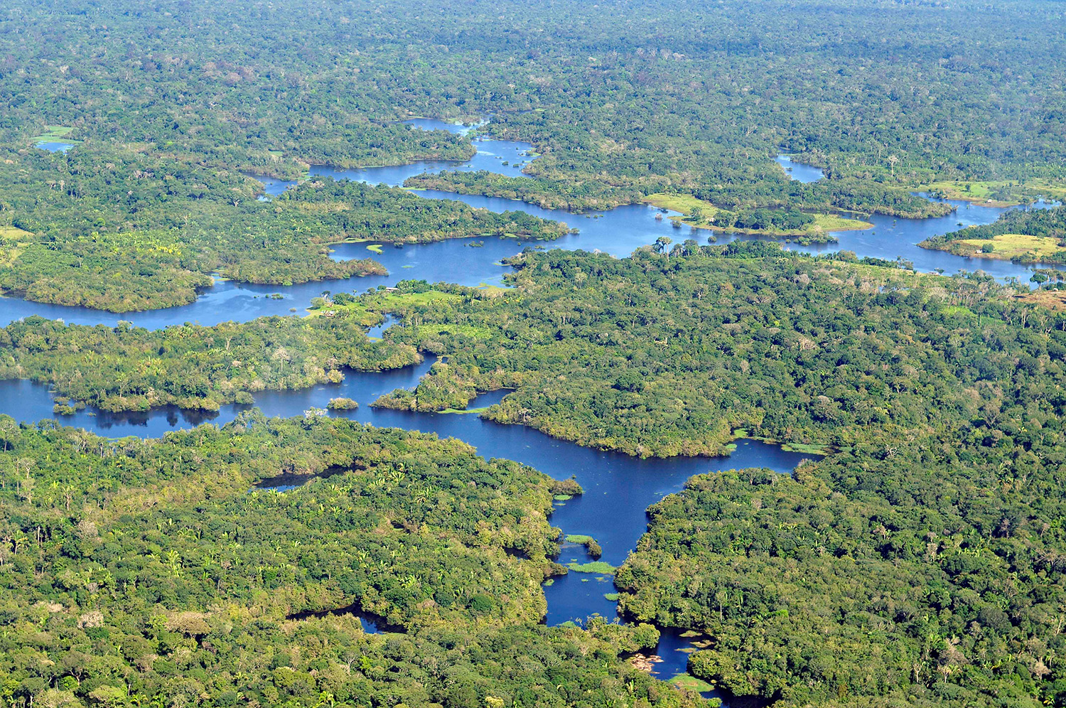
Nature’s masterpiece—The breathtaking expanse of the Amazon Rainforest. Photo by Neil Palmer/CIAT, under the CC BY-SA 2.0 <https://creativecommons.org/licenses/by-sa/2.0> license, via Wikimedia Commons.
Bariloche, Argentina—Patagonia’s Alpine Gem
Bariloche, officially known as San Carlos de Bariloche, is a picturesque city located in the Argentine Patagonia, nestled within the Andes Mountains and surrounded by stunning lakes, forests, and snow-capped peaks.
Known for its Swiss-like architecture and chocolate shops, Bariloche is a year-round destination offering outdoor adventures like skiing in the winter and hiking, fishing, and kayaking in the summer. The nearby Nahuel Huapi National Park adds to its natural allure, making it a popular spot for nature lovers and adventure seekers alike.
With its charming town center and breathtaking landscapes, Bariloche is often referred to as the gateway to Patagonia.
Bariloche Quick Facts:
- Location: Bariloche is located in the Argentine Patagonia, within the province of Río Negro, and is surrounded by the Andes Mountains and Nahuel Huapi Lake.
- Language: The primary language spoken in Bariloche is Spanish. While Spanish is the official language and most widely spoken, you may also find some locals and people working in the tourism industry who speak English, especially in hotels, restaurants, and tour agencies.
- Currency: The currency used in Bariloche is the Argentine peso (ARS). While credit cards are widely accepted, it’s a good idea to carry some cash for smaller establishments and rural areas.
- Best Time to Visit: Bariloche is a year-round destination. Winter (June to September) is ideal for skiing and snowboarding, while summer (December to March) is perfect for hiking, biking, and water activities.
- Climate: Bariloche experiences a temperate climate with cold, snowy winters and mild, sunny summers. Be prepared for rapidly changing weather, especially in the mountains.
- Transportation: Bariloche is accessible by plane, bus, or car. The nearest airport is Teniente Luis Candelaria International Airport, located about 13 km from the city center. Public transportation is available, but renting a car can give you more flexibility to explore.
- Local Cuisine: Bariloche is known for its delicious Patagonian cuisine, including trout, lamb, and regional specialties like empanadas. Don’t miss the local craft beers and wines.
- Safety: Bariloche is generally considered a safe destination for travelers; however, as with any travel destination, it’s important to exercise common sense and take standard precautions.
- Top Tourist Attractions: Cerro Catedral, Cerro Otto, Lago Nahuel Huapi, Lago Moreno, Civic Center, Tronador Mountain, Nahuelito Park, Bosque de Arrayanes, Puerto Pañuelo, Isla Victoria.
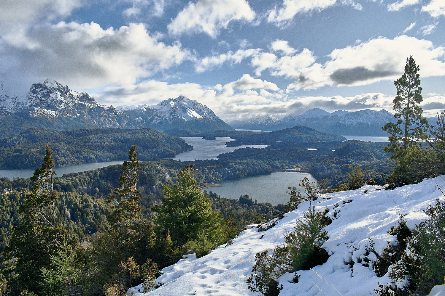
The iconic panoramic view of San Carlos de Bariloche from the summit of Cerro Campanario. Photo by ShingLord19, via the CC BY-SA 4.0 <https://creativecommons.org/licenses/by-sa/4.0> license, via Wikimedia Commons.
Cuenca, Ecuador—Ecuador’s Colonial Charm and Culture
Cuenca is a picturesque city renowned for its well-preserved colonial architecture and rich cultural heritage. Nestled in the Andes Mountains, Cuenca boasts a UNESCO World Heritage-listed historic center that highlights its charming cobblestone streets, ornate churches, and traditional markets.
Cuenca’s numerous galleries and cultural festivals reflect its vibrant arts scene. Visitors can explore stunning landmarks such as the New Cathedral with its striking blue domes and the historic Church of Santo Domingo. Additionally, Cuenca’s scenic setting along the Tomebamba River offers delightful strolls and views.
The city is also a gateway to natural wonders, such as the Cajas National Park, known for its breathtaking highland landscapes, diverse flora and fauna, and excellent hiking opportunities.
Cuenca Quick Facts:
- Location: Cuenca is located in the southern Andes of Ecuador, at an altitude of about 2,560 meters (8,400 feet) above sea level.
- Language: The official language is Spanish, but many locals also speak Kichwa, an indigenous language.
- Currency: The currency used is the US Dollar (USD).
- Climate: Cuenca has a mild, temperate climate with temperatures ranging from 10°C to 20°C (50°F to 68°F) year-round. Expect occasional rain, especially in the afternoons.
- Best Time to Visit: The best time to visit is during the dry season, from June to September.
- Transportation: Cuenca has a well-developed public transportation system, including buses and a modern tram system. Taxis are also widely available.
- Safety: Cuenca is generally safe, but it’s always wise to take standard precautions, especially in crowded areas.
- Top Tourist Attractions: Key attractions include the New Cathedral, the Church of Santo Domingo, the Pumapungo Archaeological Park, and the vibrant historic center.
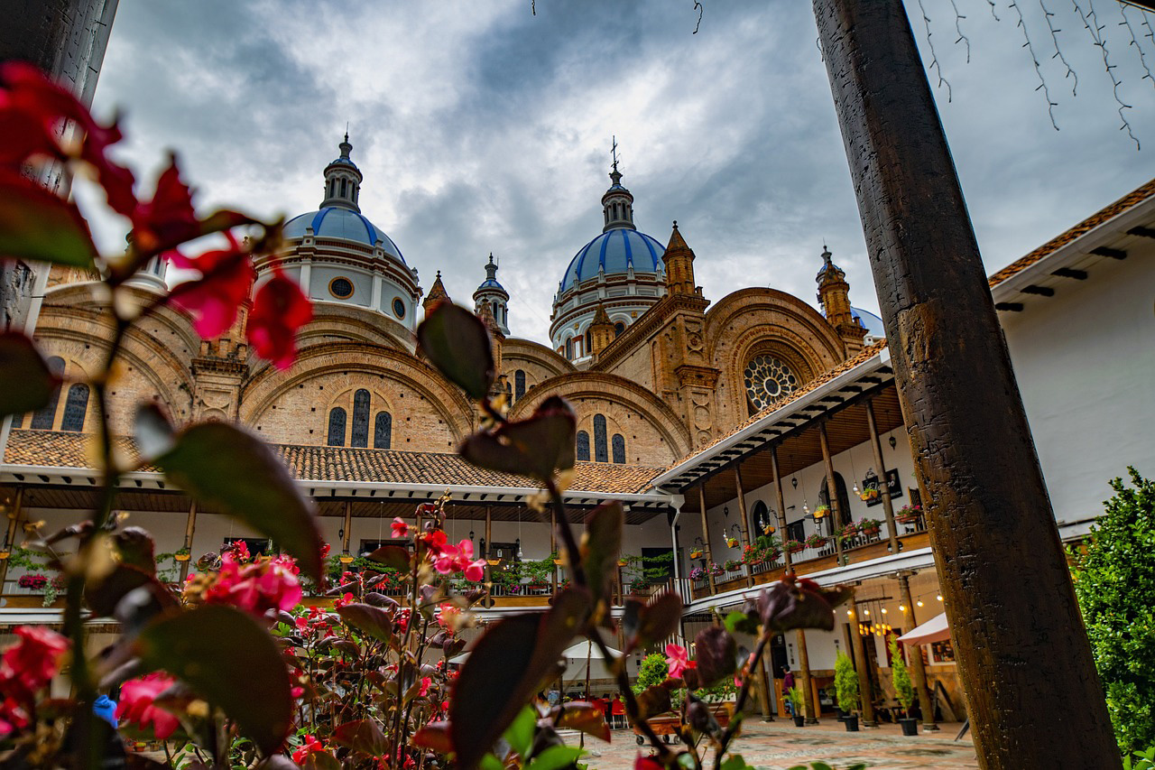
Marvel at the stunning blue domes of Cuenca’s New Cathedral, an iconic symbol of the city’s rich history and architectural beauty. Photo by fernandozhiminaicela on Pixabay.
Ouro Preto, Brazil—Brazil’s Historic Colonial Gem
Ouro Preto, located in the mountains of Minas Gerai, is a historic gem that captures the essence of the country’s colonial past. Founded during the Brazilian Gold Rush in the 17th century, the town is famed for its remarkable baroque architecture, with ornately decorated churches, such as the Church of Saint Francis of Assisi, standing as masterpieces of colonial artistry.
The town’s steep, cobblestone streets wind through a landscape of lush hills and valleys, leading visitors to discover a wealth of history in its museums, colonial buildings, and artisanal shops.
Ouro Preto, a UNESCO World Heritage site, offers a rich cultural experience where the legacy of Brazil’s colonial era is vividly preserved, making it a must-visit destination for history enthusiasts and travelers alike.
Ouro Preto Quick Facts:
- Location: Located in the state of Minas Gerais, Brazil, about 100 km (62 miles) southeast of Belo Horizonte.
- Altitude: Approximately 1,100 meters (3,600 feet) above sea level.
- Language: Portuguese is the official spoken language.
- Currency: Brazilian Real (BRL).
- Climate: Mild temperatures year-round, but it can get chilly at night, especially during winter (June to August).
- Best Time to Visit: April to September (dry season), when the weather is cooler and there is less rain.
- Transportation: Walking is the best way to explore the town due to its steep, narrow streets.
- Safety: Generally safe, but be cautious of slippery cobblestones, especially after rain.
- Top Tourist Attractions: Praça Tiradentes, Igreja de São Francisco de Assis, Museu da Inconfidência, Mina du Veloso, Igreja Nossa Senhora do Carmo, Casa dos Contos, Igreja Matriz de Nossa Senhora do Pilar, Ouro Preto University (UFOP), Museu de Ciência e Técnica, Igreja de Nossa Senhora do Rosário dos Pretos, Opera House (Teatro Municipal de Ouro Preto), Museu do Oratório.
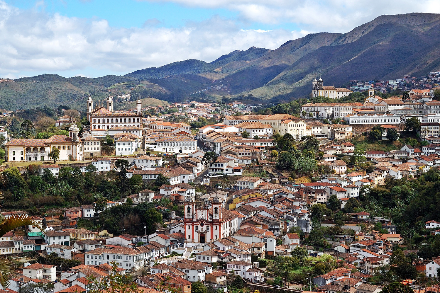
Step back in time with the colonial charm and rich history of Ouro Preto, Brazil’s gem of Baroque architecture. Photo by Rosino, under the CC BY-SA 2.0 <https://creativecommons.org/licenses/by-sa/2.0> license, via Wikimedia Commons.
Ready to start exploring the best places to visit in South America? Whichever destinations you choose, you’re in for an exciting journey through the continent’s rich cultural heritage, stunning architecture, and diverse landscapes. You might even fall in love with what you see and find yourself planning a return trip for more!
Contact our team to start customizing your dream trip to South America with an expert travel advisor today.

